Patty and I spend a fair bit of time around “The Delta.” For anyone from outside “The Bay Area,” “The Delta” refers to the 1,000+ square mile area where the Sacramento and San Joaquin Rivers merge and drain into San Francisco Bay.
According to Wikipedia, about half of the total river flow volume in California flows through The Delta. In a water-starved western state like California, that makes The Delta a critical resource and, of course, the subject of much discussion and controversy.

The dialogue about water use in California always has an element of the zero sum game with the three big users vying for the limited supply. The Delta is often in the middle of the discussion since it is the point where many of the decisions are implemented. That is, water is either allowed to flow towards the ocean (environmental use) or is diverted for irrigation and municipal use.
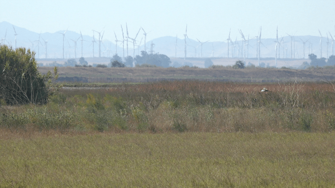
Much of The Delta is at or near sea level including our hunting club Hastings Island Hunting Preserve which is surrounded by levees and sloughs. There are, however, some rolling hills to the west. The Montezuma Hills are home to several large wind farms making The Delta not only important to Californians for water but also for power.
The windmills are often in the background of pictures and videos that I’ve taken while dog training or hunting with Patty at HIHP but we’d never taken an extra few minutes to go explore some of the roads through those hills.

Yesterday, after a great couple of hours of running and pre-season training, Patty and I finally went to have a closer look. The newest windmills are absolutely massive. The scale of the entire wind farm is hard to imagine when the monster right beside you is hundreds of feet tall and you can see hundreds of others stretching across the horizon. Even Mount Diablo, one of the Bay Area’s tallest peak, looks small in the distance relative to these giants.

We only spent a few minutes off of the highway and there are plenty more roads to check out in these hills. We’ll be back.
